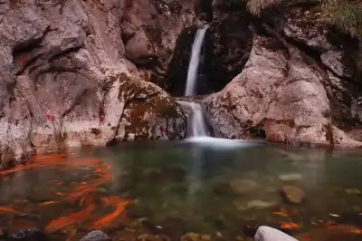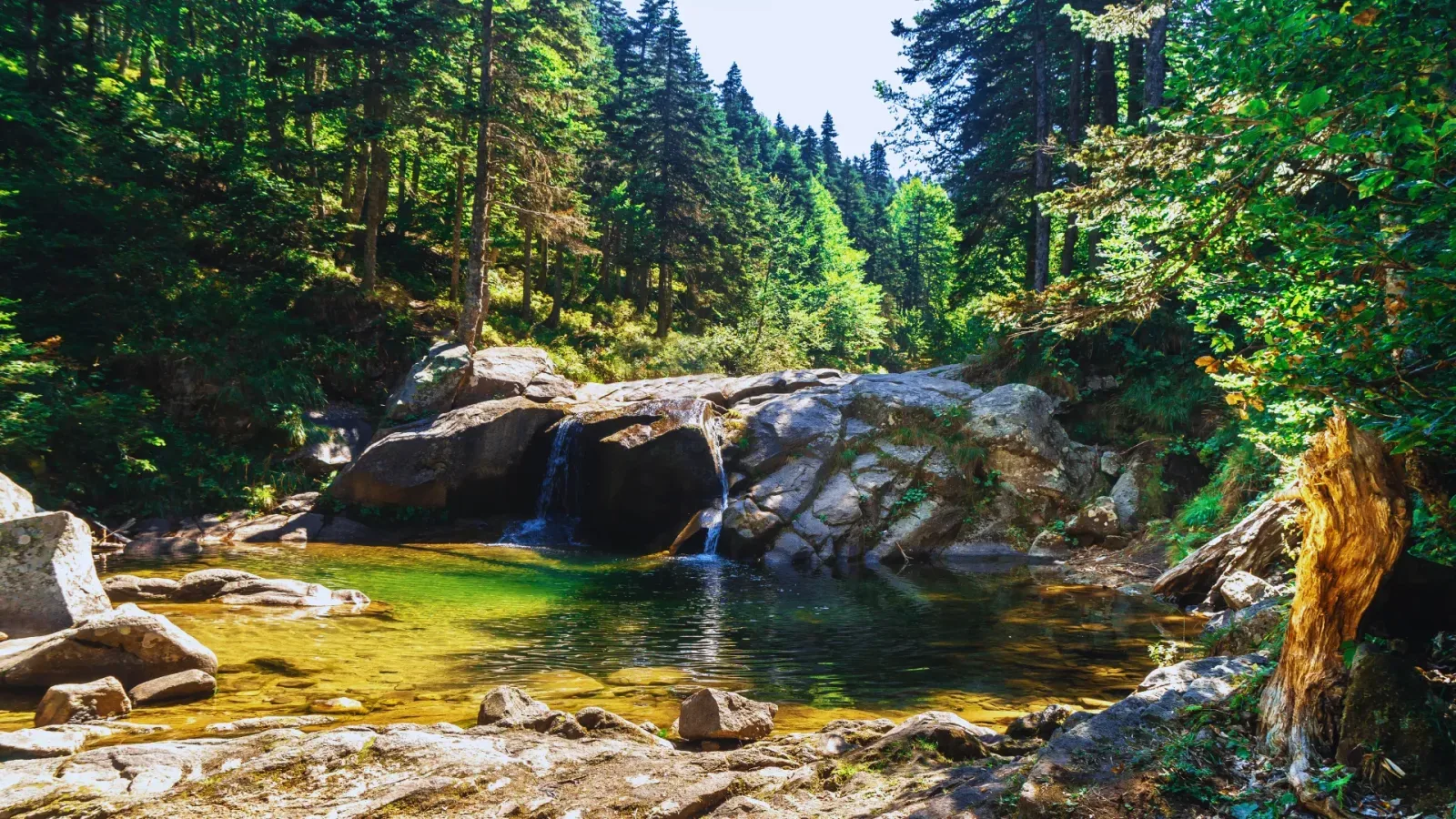
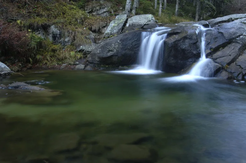
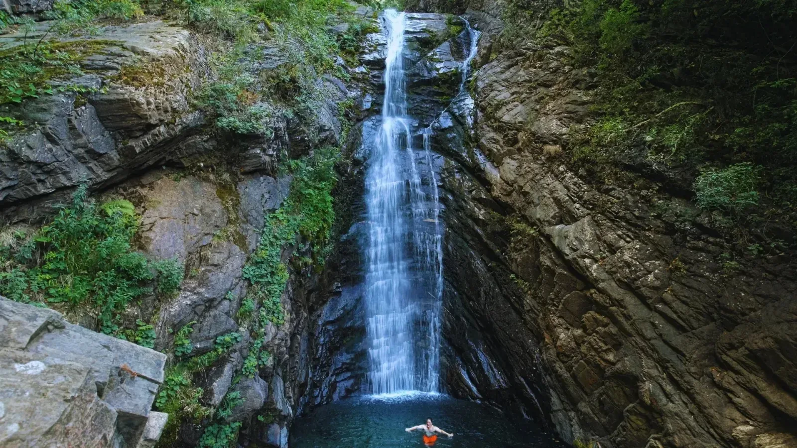
Softaboğan Waterfall is a free-to-visit natural attraction located on the slopes of Mount Uludağ in Bursa's Osmangazi district, surrounded by pine forests and swollen by melting snow in spring.
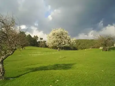
Hidden on the slopes of Mount Uludağ covered with rich vegetation in Bursa's Osmangazi district, Softaboğan Waterfall stands out as one of the city's finest nature getaways. Located in the Dombay Çukuru Valley to the southeast of Bakacak viewpoint, the waterfall enchants visitors with its cool canyon air, the soothing sound of rushing water, and lush green surroundings, even though it does not feature a dramatic high drop. Melting snow from Mount Uludağ significantly increases the water flow in spring, making the landscape even more impressive.
The Çobankaya campsite or Bakacak viewpoint are typically used as starting points to reach the waterfall. Following the stream bed, the trail offers a delightful route for those seeking a hiking experience. Picnic areas shaded by pine trees make the surroundings ideal for family trips as well. Tucked away on the descent from Bakacak Hill, which overlooks the Bursa plain, this quiet corner of nature is a must-visit spot for anyone wanting to escape urban noise.
Related explorations: Things to do in Bursa, Dikilitaş (Obelisk / Beştaş) - İznik, Ahmed Paşa Medresesi (Geyikli Medrese), İne Bey Medresesi, Bursa Balıkesir: 2-Day Route from Marmara to the Aegean.
Guide's Note
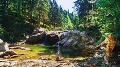
Softaboğan Waterfall welcomes visitors seeking a peaceful atmosphere surrounded by lush green flora and fresh mountain air. Many travelers highlight the serene mood and refreshing air of the site. Reaching the waterfall requires roughly a 20-minute hike along a forest trail, so traveling light is recommended. The pool formed at the base of the waterfall is not very deep, though depth can vary in certain spots.
Some visitors report exceeding their expectations and appreciate the helpful attitude of local staff. However, as some reviews are quite brief and general, it is best not to make broad generalizations. The water flow is not exceptionally high; visitors expecting a roaring, heavy torrent might feel disappointed.
- Transportation and parking issues: Parking space near the trail head is extremely limited. It is strongly advised not to park along the roadside, as gendarmerie forces are known to tow vehicles.
- Navigation can be tricky: There is a risk of getting lost along the trail shaded by tall trees; researching the route in advance is recommended.
- Broken glass: Visitors have reported broken glass fragments in the area, so watch your step while walking.
- Do not leave trash: Multiple visitors urge travelers to respect nature and pack out all garbage.
Best Time to Visit
If you want to see Softaboğan Waterfall at its most impressive, aim to visit between April and June. During these months, snow accumulating on Mount Uludağ's peaks melts, significantly increasing the waterfall's flow and making both its sound and appearance far more striking. The vibrant green of the pine forest in May is an added bonus.
Autumn months, especially October and November, carry a unique appeal for photography enthusiasts as the forest turns into shades of yellow and orange. While the water volume may drop in mid-summer, the cool canyon air and shaded picnic spots still offer a refreshing escape on hot days. Due to slippery roads in winter, visitors without mountain driving or hiking experience are advised to exercise caution.
How to Get There
The most convenient way to reach the waterfall is by private car. Drive from central Bursa towards Mount Uludağ up to the Çobankaya campsite. From here, walk roughly 500 meters along the paved road towards Bakacak to reach the trail head.
For those using public transport, minibuses departing from Tophane in central Bursa are an option; however, be prepared to walk or arrange additional transport for the last few kilometers. An alternative way to reach the waterfall is descending directly through the stream bed, though this adventurous route requires suitable footwear and extra care.
Hiking Trail & Route Details
The most popular route is the Sarıalan–Çobankaya–Softaboğan Waterfall trail. According to Wikiloc data, this route covers approximately 10 km with an elevation gain of 297 meters, rating moderate-to-challenging in technical difficulty. The maximum altitude reaches 1,745 meters.
Hikers choosing the shorter path starting from Bakacak are greeted by sweeping vistas of Dombay Çukuru Valley during the descent. The path down the rocky stream bed is shorter but requires caution. Sturdy hiking shoes are essential on both routes; visitors in sneakers often struggle on wet and slippery surfaces.
Photography Spots
There are several great photography angles around the waterfall. Approaching from the stream bed provides the classic frontally framed view of the waterfall. Early morning light filtering through the pine forest creates a dramatic, atmospheric scene between the tree trunks.
Heading up to the Bakacak viewpoint rewards photographers with wide-angle panoramic shots covering the entire Bursa plain. The light playing over the valley at sunset is particularly spectacular. In spring, the water mist hovering over the rocks right in front of the fall offers excellent long-exposure photo opportunities.
Where to Eat Nearby
There are no established dining facilities in the immediate vicinity of the waterfall. It is more practical to stop by facilities around Çobankaya campsite before your hike or dine at restaurants in central Bursa. The area surrounding the waterfall is well suited for picnicking, with shaded spots beneath pine trees ideal for laying out a blanket.
On your return to Bursa, village breakfast places and barbecue joints along the Mount Uludağ road are great choices. The location is also convenient for heading into the city center to taste famous local specialties like İskender kebab and chestnut candy (kestane şekeri).
Things to Know Before You Visit
The path leading to the waterfall consists of natural terrain, making sturdy hiking shoes with good traction a necessity. Never underestimate the risk of slipping on wet rocks. If you plan to hike down the stream bed, waterproof boots or sturdy trekking sandals are recommended.
Cellular coverage can be weak or non-existent in the area, so downloading the route map to your phone or GPS device beforehand is highly recommended. Bringing sufficient water and snacks is crucial as there are no markets nearby. To protect the environment, packing out trash and avoiding open fires is essential. Keep in mind that roads can be icy in winter and early spring.
This content originates from neresigezilir.com and may not be copied without permission.
FAQ
Updated: