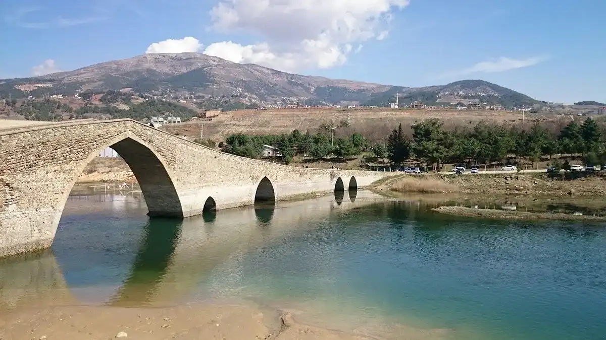
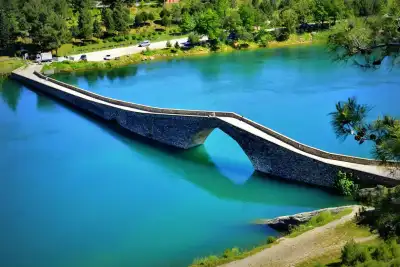
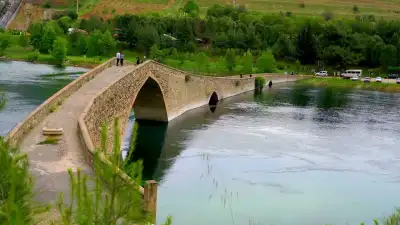
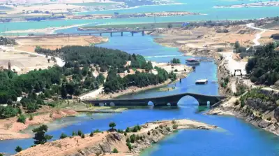
Ceyhan Bridge is a 16th-century historical structure over the Ceyhan River in Kahramanmaraş, featuring six pointed arches across its 158-meter length from the Dulkadirid era, and is free to visit.
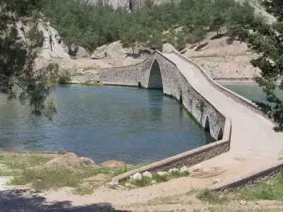
Located at the 11th kilometer of the Kahramanmaraş-Kayseri highway between the Kılavuzlu and Hasancıklı neighborhoods, Ceyhan Bridge is a historic structure believed to have been built before 1563 and attributed to the Dulkadirid Principality, which ruled the region. Having survived to the present day through various repairs during the Ottoman period, the bridge draws attention with its length of 158 meters and six pointed arch openings. Surrounded by rubble stone parapets ranging from 0.60 to 1.10 meters in height, the structure showcases the engineering capabilities of its era with cutwaters on its piers. Also known locally as Taş Köprü (Stone Bridge) or Kambur Köprü (Humpback Bridge), it served a strategic transportation function for centuries on the Maraş-Göksun-Elbistan route.
The lush forest surrounding the bridge and the clean waters of the Ceyhan River transform this spot from a simple historical landmark into a serene retreat in nature. You can enjoy a picnic while admiring the stone arches and listening to birdsong, spend time along the riverbank, or sample local delicacies at nearby fish restaurants. Please note that the 2023 earthquake affected the bridge, and restoration work has been ongoing since then. Some visitors report that access is closed and the bridge can only be viewed from a distance; therefore, it is advisable to confirm whether it is open before your visit.
Related places: Taş Medrese, Saraçlar Bazaar, Yedikuyular Ski Center.
History of the Bridge
Ceyhan Bridge is believed to have been constructed before 1563, dating back to the period of the Dulkadirid Principality. Built of rubble stone, the bridge served as a critical crossing point on the historic Maraş-Göksun-Elbistan trade and travel route. Having undergone several restorations during Ottoman rule, the structure has managed to stand for over 500 years. It is also known locally as Taş Köprü (Stone Bridge) and Kambur Köprü (Humpback Bridge).
Architectural Features
The bridge measures 158 meters in length and features six pointed arches. It is lined with rubble stone parapets ranging in height between 0.60 and 1.10 meters. The triangular cutwaters (breakwaters) on its piers are significant details reflecting the water engineering capabilities of the era. The geometric arrangement of the stones and arched framework serve as tangible proof of master craftsmanship centuries ago.
When to Visit?
Spring (April–May) and autumn (September–October) are the ideal times to visit, both for comfortable weather and lush greenery around the river. While the riverbank offers a refreshing breeze in summer, shaded areas are limited, making morning visits preferable. In winter, the surroundings can be quite deserted.
Important note: The 2023 earthquake affected the bridge, and restoration efforts were subsequently launched. Some visitors mention that close access is prohibited; confirm whether the bridge is accessible before your trip via local sources or the Kahramanmaraş Provincial Directorate of Culture and Tourism.
How to Get There?
The bridge is situated at the 11th kilometer of the highway running from Kahramanmaraş city center toward Kayseri. Driving by private car is the most practical method; you can set your navigation to 'Ceyhan Köprüsü Kılavuzlu'. For those using public transport, minibuses departing from Kahramanmaraş bus station toward Kayseri are an option, though you may need to walk the final stretch.
Where to Eat Nearby?
There are riverside fish restaurants located right near the bridge. Fresh fish from the Ceyhan River is served at these venues, and many visitors choose to combine their sightseeing with a lunch or dinner here. Alternatively, if you pack picnic supplies, you can enjoy your own meal in the designated recreation area.
Best Photo Spots
The most striking photos are taken from the riverbank at low angle near water level, where the reflection of the arches and the forest background add exceptional depth to the composition. Looking out over the river valley from atop the bridge also offers a strong perspective. Photographs taken closer to sunset capture the rich texture of the historic stone beautifully.
Things to Keep in Mind
Restoration work initiated after the 2023 earthquake is ongoing, and access to the bridge may be restricted from time to time. Some visitors report a lack of clear directional signage at the highway exit, so using GPS navigation is recommended. Shaded areas are limited during summer, so bring plenty of water and sun protection. As this is a natural environment, please remember to take your trash with you.
This content originates from neresigezilir.com and may not be copied without permission.
Ceyhan Bridge (Stone Bridge) Videos
Ceyhan Bridge (Stone Bridge) videos load when you open this section to keep the page fast.
Show videos
FAQ
Updated: